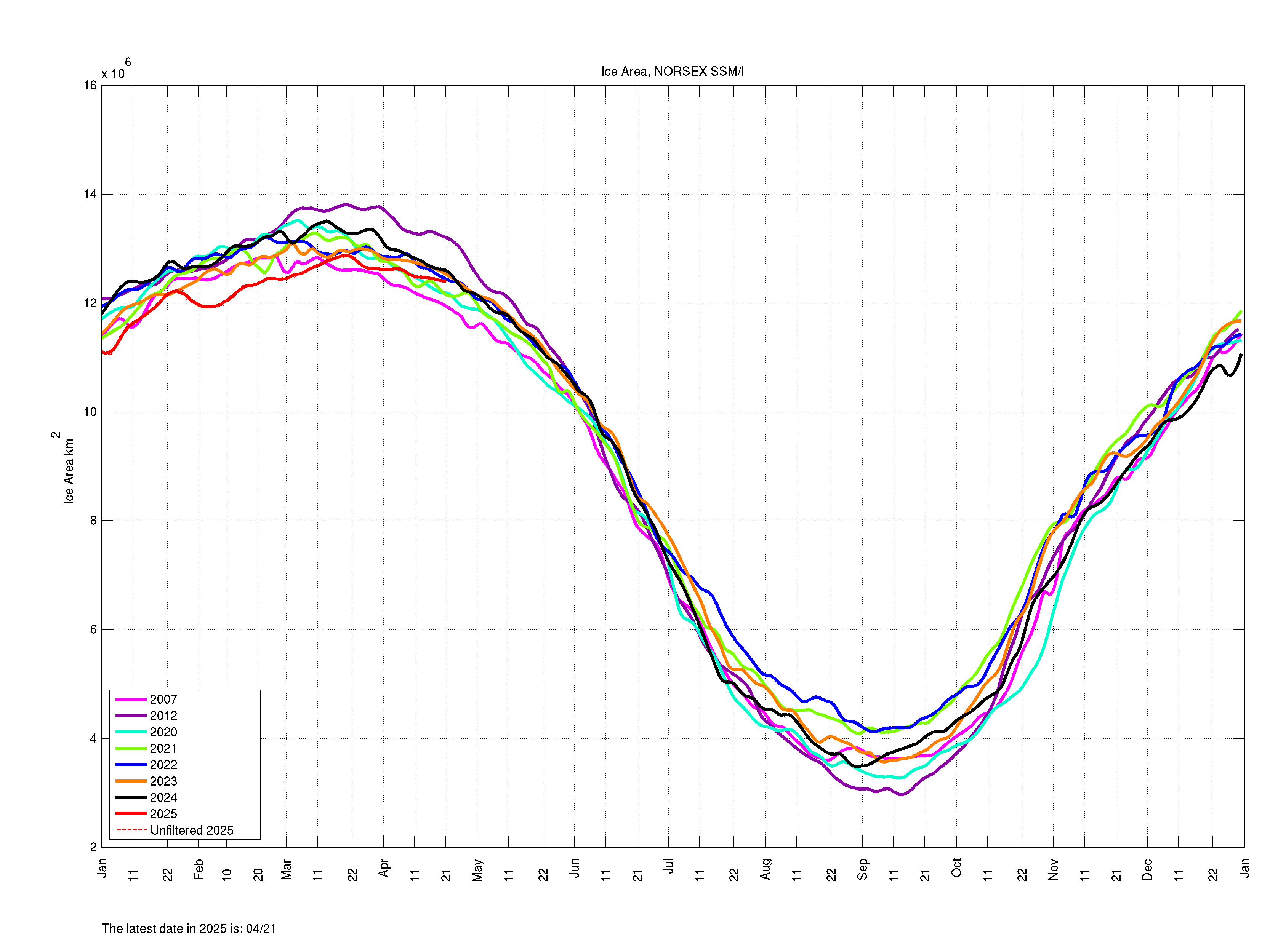
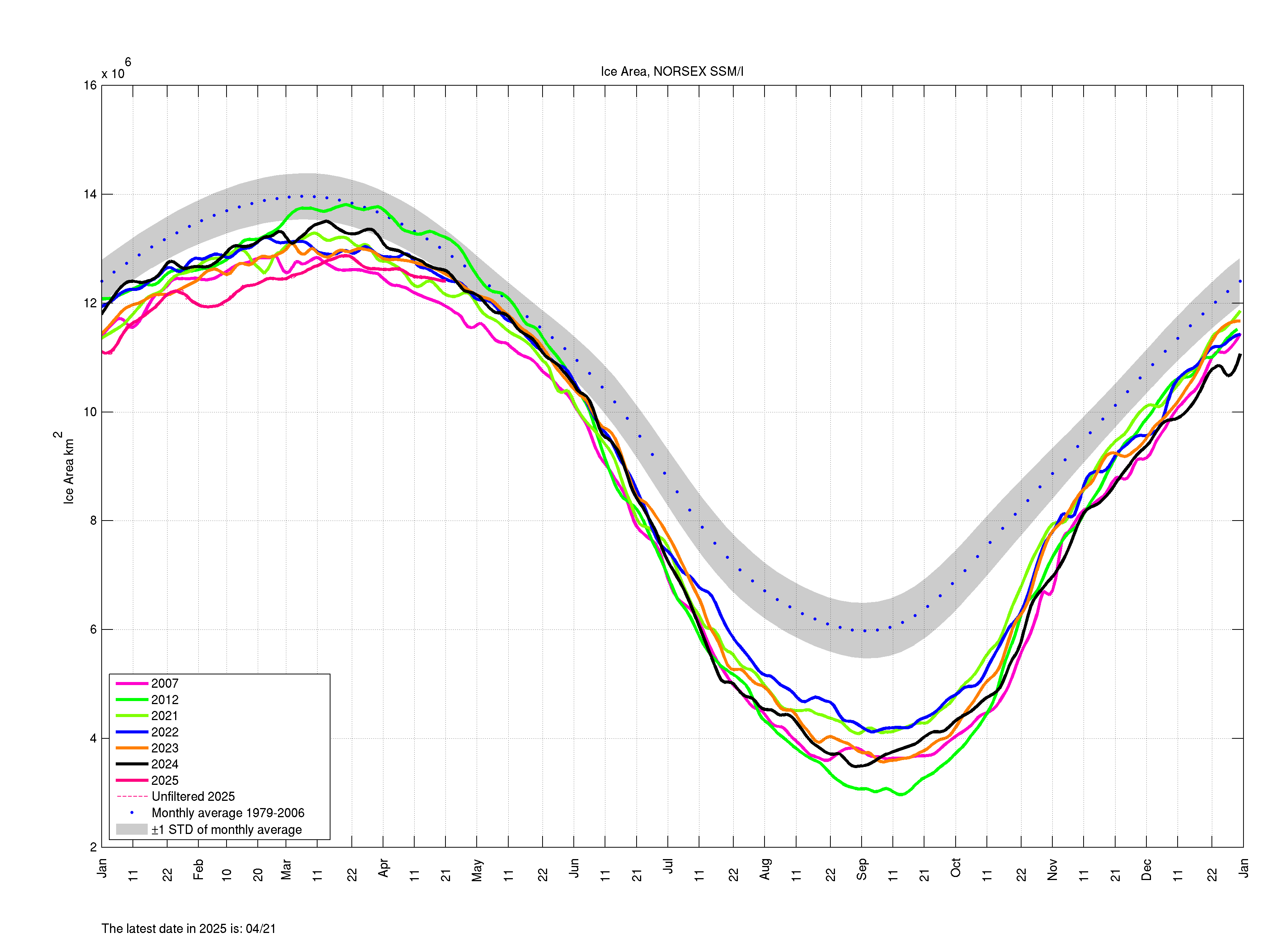
Sea ice area, filtered by Rloess method, Copyright: NERSC
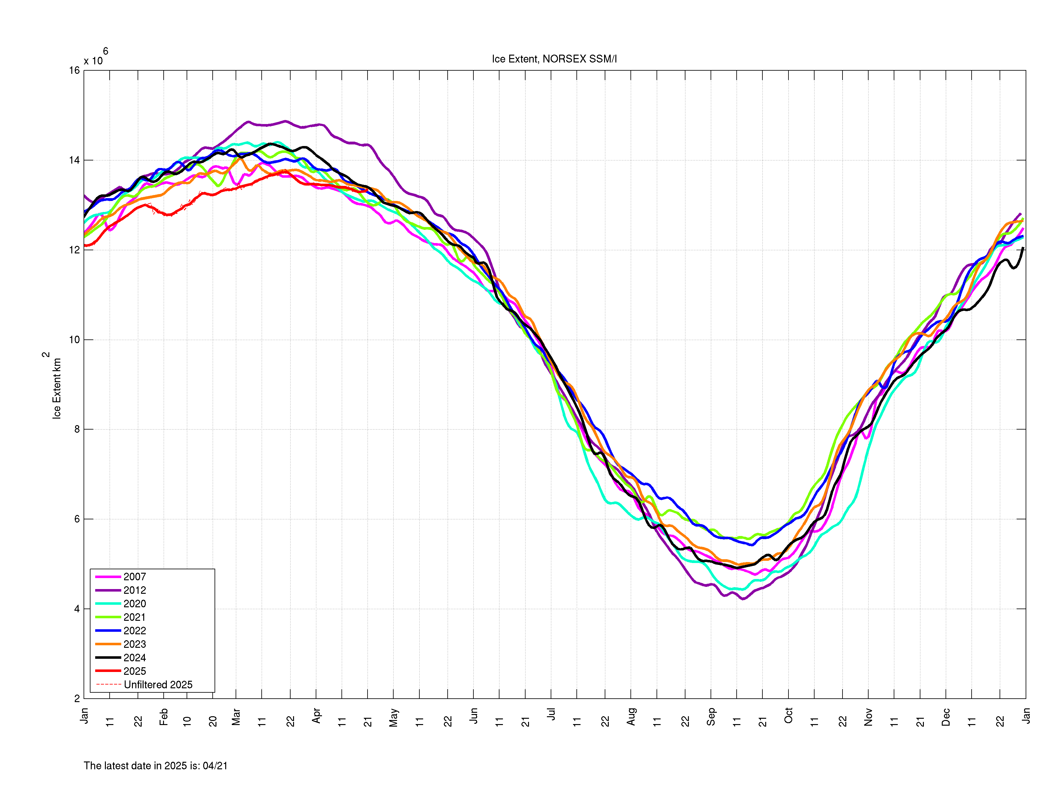
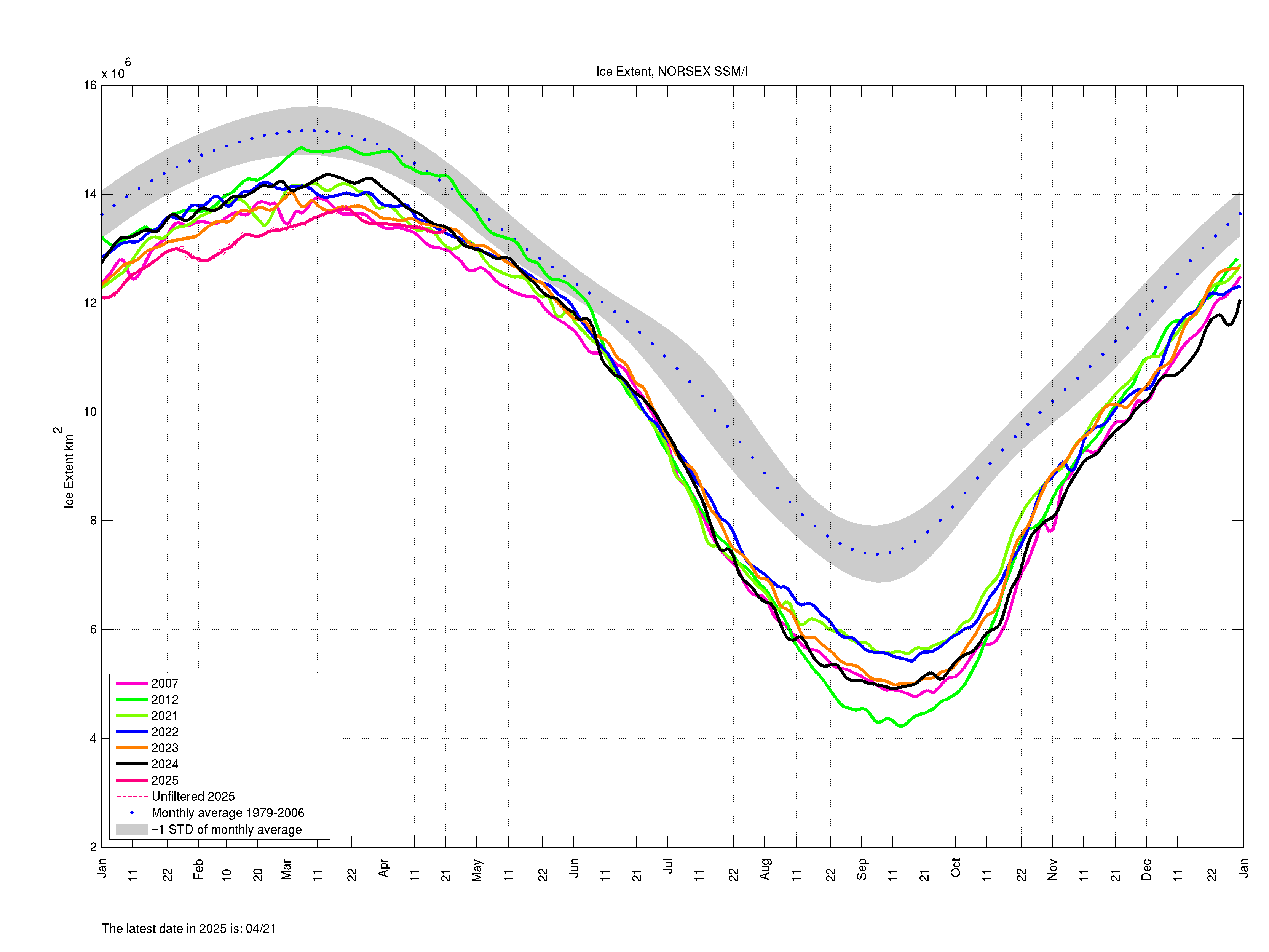
About Ice Extent and Ice Concentration
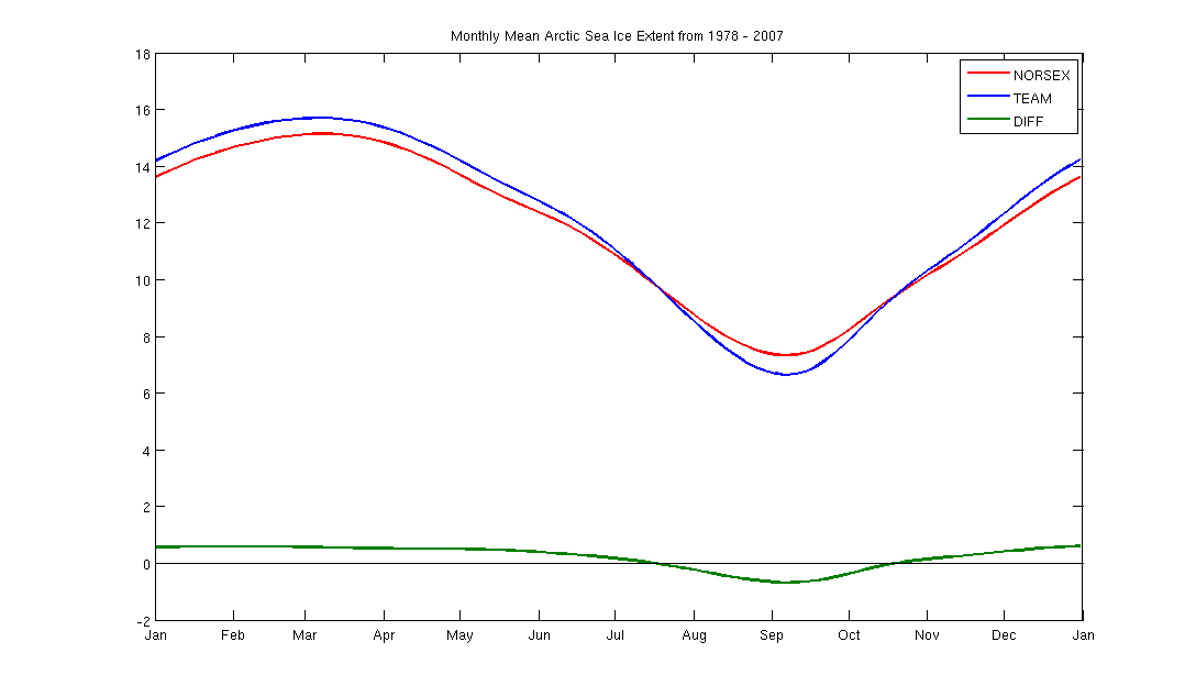
Ice extent is the cumulative area of all polar grid cells of the Northern Hemisphere that have at least 15% sea ice concentration, using the NORSEX algorithm. Ice area is the sum of the grid cell areas multiplied by the ice concentration for all cells with ice concentrations of at least 15%. Ice extent and ice area are calculated for a grid resolution of 25 km. The difference between extent and area for our data is always positive. This difference represents the area of the open water in the pixels partly covered by ice (i.e. ice concentration less than 100%). In other words, ice area takes into account that there is a fraction of open water in pixels with ice concentration above 15% and below 100%". Ice extent does not include this effect and gives therefore a higher number of square kms than ice area does.
Data Attribution: The data provided on this website is sourced from the Nansen Environmental and Remote Sensing Center (NERSC) Arctic Sea Ice Observing System (https://iceobs.nersc.no), using the NERSC developed NORSEX Sea Ice algorithm. It uses DMSP SMM/I Brightness temperatures (https://nsidc.org/). It is updated daily and intended for informational purposes only. If you use or reference this data, please attribute it to "NERSC Arctic Sea Ice Observing System" and include a link back to this website (https://iceobs.nersc.no). NERSC makes no warranties regarding the accuracy or completeness of the data.